Flood and Drainage Monitoring

Whole systems monitoring / AI prediction & scenario planning

Updated

Overview

SIYTE brings water levels, pump activity, weather information, public data (e.g. Environment Agency, Natural Resources Wales), CCTV analytics and asset data into one, live operational view. Teams can understand conditions remotely, verify alarms and coordinate earlier action across drainage and flood risk locations. Engineers and operators can also use SIYTE AI for scenario planning and to predict upcoming risks.

The challenge

The warning signs of flooding are spread across drainage, pumping, CCTV and sensor systems, frequently from different vendors and rarely share a single user interface. Without a joined-up, live picture, engineers struggle to understand “whole systems” operations and cannot use AI to assist in predictive scenario planning.

The solution

What your team sees with SIYTE

The Very Resilient Railway
Environmental Monitoring
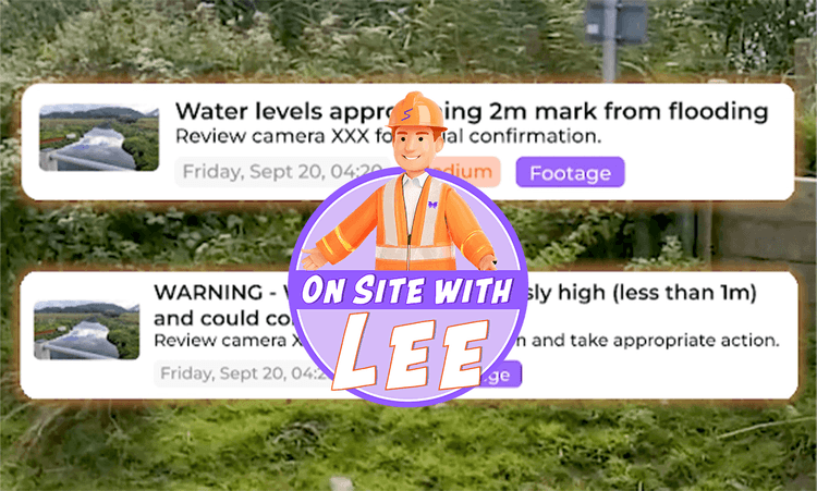
Notifications
Most recent (Max 50)Date: Newest first ⇅
CCTV Analytics: Surface water detected on rail corridor. Estimated distance to rail head: 120mm.
Medium12 min ago
Predictive: Water levels at Site A risen to within 100mm of railhead. With forecast rainfall, prediction to reach rail head is 3.5 hours.
High28 min ago
Pump Status: Pump 010 at Site A exceeding vibration and temperature thresholds; prioritised on maintenance schedule.
Medium1 hour ago
Weather Alert: Met Office warning: 18–22mm rainfall forecast for the next 6 hours across the Holcombe corridor.
High2 hours ago
Track Water LevelNow
Safe
Alert
Flood Risk IndexNow
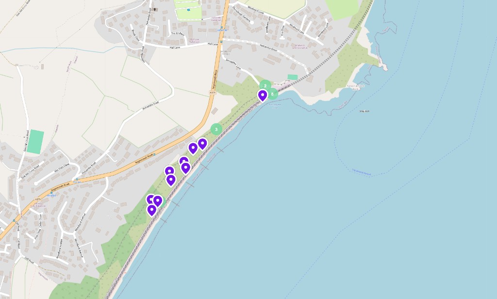
Coastal earth movement sensor map
Holcombe · 13 sensors live
Ask SIYTEToday
SIYTE AI
Did the water level reach the railhead on 27th Jan?
No — the Down Cess stayed around 10–14mm below the rail head all day, with the closest reading of 7mm at 15:45.
What would have happened with 25mm more rainfall?
The water would likely have reached or breached the rail head, creating a serious flood risk to the track.It would have been a major flooding incident requiring emergency response.
Ask a follow-up question…

Capabilities

Intelligence to action

  1. Whole System View

    Integrate water levels and thresholds, pump activity, faults and power, weather, third party data (including Environment Agency sensors) & CCTV into a single web interface available on any device.

  2. AI Analysis for Asset Teams

    Conversational AI interface for Asset and Operations teams to understand trends, predict events and perform scenario planning.

  3. Operational Simplicity

    Multi-channel alerts from a simple unified interface for response teams, with camera evidence to verify alarms before intervention and AI chat capability to understand risks.

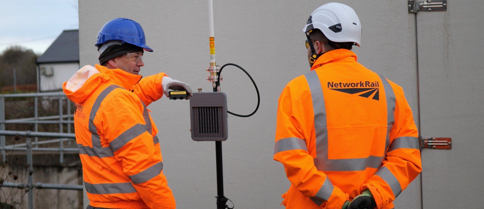
Network Rail engineers with a SIYTE sensor at Chipping Sodbury
  • Case Study
  • Rail
  • Extreme weather

Chipping Sodbury Flood Monitoring Solution

Network Rail Wales & Western Engineering & Asset Management

The speed with which this was delivered was incredible. Any questions were not only answered promptly, but in detail.

Overview

During a series of flooding incidents, SIYTE proved invaluable in helping asset engineers identify how complex drainage and pumping systems interlinked, resulting in the early development of mitigation strategies.

By integrating real-time and historical data, the platform has provided evidence to ensure mitigation efforts won’t impact river levels and enables ongoing monitoring to assure this. The solution enhances decision-making, shifts responses from reactive to proactive, and builds confidence among stakeholders, reducing reliance on manual inspections and train driver reports.

The challenge

Flooding at Chipping Sodbury, on the high-speed route between Swindon and Bristol, is both a frequent and costly event. Closing the line causes extensive delays, with significant resultant cost impact. In 2018, an 11 million litre lagoon was constructed which stores water during storm events to limit flooding on the railway line. Whilst this had a positive impact, this location continued to flood, and a lack of remote visibility of site data made evaluating how flooding develops in real-time challenging.

Before this solution, Network Rail had to rely on train driver reports and then send an engineer to site to assess what operational restrictions, if any, were required. This caused delays in decision-making, and with a complex flood management system spread over a mile, it was difficult to understand and optimise the site.

The solution

Network Rail’s Wales and Western Region have an objective to drastically reduce delay minutes due to flooding within the current Control Period and beyond at Chipping Sodbury. It was clear that improved remote monitoring was required to reduce delays and improve passenger experience.

Before Purple Transform and Central Alliance got involved, sensors to monitor flooding were already installed but, as George Barratt from the Asset Strategy & Planning team attested, data was not easy to obtain, interpret and understand in a timely manner.

George also said, “It became apparent just how complex the operation of the Chipping Sodbury site was: we needed to build an understanding of the whole system and how different assets were interlinked, to improve performance now and into the future. Having all the monitoring data in one, simple-to-understand, user interface was key to this.” This is why the Asset Strategy & Planning team chose the SIYTE Environmental and Situational Awareness platform from Purple Transform.

The impact

On 6th January, flooding on the line through Chipping Sodbury caused the railway to be closed for 6 hours. This was the first time SIYTE could be used in anger. Engineers were able to determine how different drainage systems interlinked and electrical pumps performed during these events, allowing for a more thorough understanding. By comparing historical water level data across different sections of the site, they could also prove that the site did not have adverse effects on surrounding river levels.

While the increased monitoring helps to provide more information and understanding, feeding into long term solutions, it also supports maintenance and operational teams, allowing them to make quicker and safer decisions remotely without the immediate requirement to attend site.

  • Delay minutes avoided7,000*

    Reported by Network Rail for a SIYTE flood monitoring deployment during winter 24/25.

  • Data points every day100m

    Readings from water-level sensors, pumps, weather stations and cameras, brought into one live view.

  • Systems integrated24

    Third-party systems connected, from sensing and pump control to weather and Environment Agency data.


On site

FAQ

Frequently asked questions

SIYTE engineers will work with you. In most cases, we can integrate all the systems you already have. Where new sensors are required, we can advise you and even manage procurement of these devices.

Yes. We can use AI in two ways. We can analyse images from cameras, such as solar cameras, for events such as surface water and we can surface data securely to a conversational AI agent to enable trend analysis, scenario planning and predictions.

Built for
Drainage and asset engineers, route asset management teams
Industry
Rail

Keep exploring

Related reading

See it in the field

Let's talk

We'd love to hear from you to discuss how SIYTE can transform your operations or book you in for a personalised demo. Please leave your details and we'll get back to you shortly.