Geotechnical Monitoring

Operational intelligence for earthworks & geotechnical assets

Updated

Overview

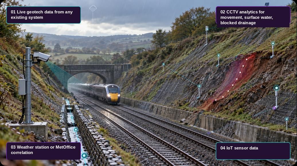
SIYTE unifies data from any camera, sensor or existing monitoring system, including Senceive, LB Foster and other third-party feeds, into a real-time intelligence layer for earthworks and geotechnical assets, delivered in a flexible user-friendly web and mobile interface.

The challenge

Operations centres and asset teams struggle to cope with the number of interfaces they have to deal with and the inconsistency of alerts they receive, which are frequently technical and lack context. In addition, the reluctance to add new interfaces creates vendor lock in, stifling innovation and competition.

The solution

What your team sees with SIYTE

The Very Resilient Railway
Environmental Monitoring
Notifications
Most recent (Max 50)Date: Newest first ⇅
CCTV Analytics: Surface water detected on rail corridor. Estimated distance to rail head: 120mm.
Medium12 min ago
Predictive: Water levels at Site A risen to within 100mm of railhead. With forecast rainfall, prediction to reach rail head is 3.5 hours.
High28 min ago
Pump Status: Pump 010 at Site A exceeding vibration and temperature thresholds; prioritised on maintenance schedule.
Medium1 hour ago
Weather Alert: Met Office warning: 18–22mm rainfall forecast for the next 6 hours across the Holcombe corridor.
High2 hours ago
Track Water LevelNow
Safe
Alert
Flood Risk IndexNow
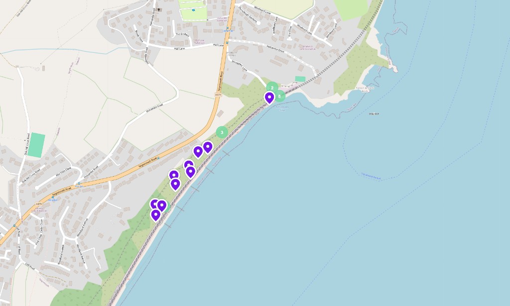
Coastal earth movement sensor map
Holcombe · 13 sensors live
Ask SIYTEToday
SIYTE AI
Did the water level reach the railhead on 27th Jan?
No — the Down Cess stayed around 10–14mm below the rail head all day, with the closest reading of 7mm at 15:45.
What would have happened with 25mm more rainfall?
The water would likely have reached or breached the rail head, creating a serious flood risk to the track.It would have been a major flooding incident requiring emergency response.
Ask a follow-up question…

Capabilities

Intelligence to action

  1. Data Unification

    Integrate sensing systems from any vendor, IoT sensors, CCTV analytics & weather data into one dashboard & system.

  2. Whole System View

    Remotely accessible web and mobile dashboard to access and analyse all systems data and alerts in one place.

  3. Whole System AI Analysis

    Utilise SIYTE AI via web or mobile to understand trends, predict events and enable risk-based maintenance.

Geotechnical Monitoring: what SIYTE monitors
  • Case Study
  • Rail

The solution

SIYTE helps operators move from reactive to proactive earthworks management whilst maintaining full flexibility of vendors. SIYTE will integrate with any vendor ensuring existing systems can continue to be used when new vendors are onboarded.

SIYTE will integrate:

  • IoT sensing from any vendor
  • CCTV cameras, with analytics
  • Weather stations and public data

SIYTE will also directly manage any LoRaWAN connected IoT sensor for earthworks monitoring or a wide range of trackside applications.

Dawlish, Devon

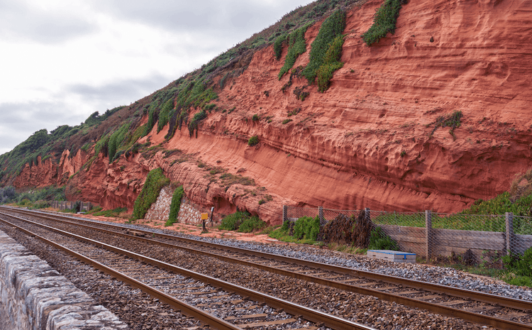
At Dawlish, where the railway runs alongside steep cliffs, SIYTE and Telent deployed a joint solution: IoT sensors along the cliffs detect rockfalls and send automated alerts to control rooms and approaching trains, while smart cameras improve safety at Dawlish and Dawlish Warren stations.

Further reading: Helping to Improve Railway Safety with our Partners Telent.
FAQ

Frequently asked questions

The SIYTE dashboard is web based and can be accessed remotely on web or mobile devices.

Yes. SIYTE AI can be used to correlate and analyse data from any system to perform scenario planning, trend analysis and predict future events.

Built for
Geotechnical and earthworks engineers, route asset managers
Industry
Rail

Keep exploring

Related reading

See it in the field

Let's talk

We'd love to hear from you to discuss how SIYTE can transform your operations or book you in for a personalised demo. Please leave your details and we'll get back to you shortly.